Potential for Severe Storms in Alabama Today and Sunday
While not everyone will experience rain or storms, the National Weather Service warns that any storms that do form could become intense, bringing damaging wind gusts that may knock down trees and power lines. Heavy rainfall is also a possibility.
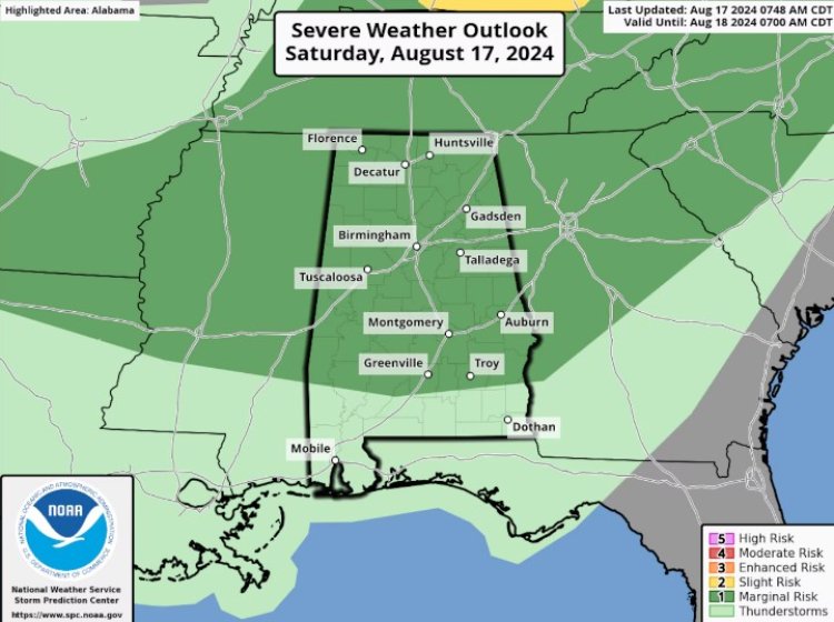
Alabama could face more rounds of strong to severe storms today and Sunday.
While not everyone will experience rain or storms, the National Weather Service warns that any storms that do form could become intense, bringing damaging wind gusts that may knock down trees and power lines. Heavy rainfall is also a possibility.
On Friday, severe storms led to downed trees and power outages in parts of northeast Alabama, according to reports to the weather service.
NOAA’s Storm Prediction Center has placed all of north and most of central Alabama under a Level 1 out of 5 (marginal) risk for severe weather today. This means that isolated severe storms could develop, with the highest likelihood occurring in the afternoon or evening.
Sunday could bring even more storms, with a Level 2 (slight) risk in place for parts of south and central Alabama, indicating a higher chance of isolated severe storms. Much of the rest of the state will also be under a Level 1 risk on Sunday.
Temperatures are expected to be very warm both today and Sunday, with heat advisories issued for the Alabama counties marked in orange. The heat index, or "feels like" temperature, could soar as high as 110 degrees in parts of south and west Alabama today.
However, relief is on the way, with slightly cooler temperatures expected to reach parts of north and central Alabama starting on Monday, bringing highs in the 80s and low 90s.


